Tuesday, 28 July 2026, 7:30
A wildfire dubbed the Twain Fire ignited on July 11, 2026, in Plumas County, California, quickly growing to 125 acres. By the morning of July 12, the fire had expanded to 276 acres and reached 10% containment. The blaze has prompted a lane closure on Highway 70 and is drawing a multi-agency response in the remote Feather River Canyon. The fire is burning in the Kingsbury Ravine area, according to officials.
According to Cal Fire, the Twain Fire was first reported at 2:04 p.m. on July 11 at just 22 acres. By 4:28 p.m., it had expanded to 125 acres. The Plumas National Forest confirmed the size and noted that the fire is burning in the Dixie Fire scar, which may influence fire behavior due to residual fuels and changed vegetation. As of 9:14 a.m. on July 12, the fire had grown to 276 acres and was 10% contained.
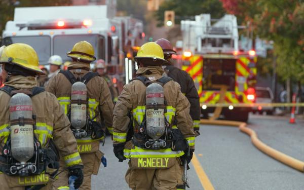
The U.S. Forest Service reports that ground and air resources from multiple allied agencies are aggressively working to contain the fire. The response is at a Type 3 level, with 177 personnel assigned. The lead agency is listed as Multiple Agencies, and the Plumas Emergency Communication Center is coordinating efforts. The cause of the fire remains undetermined according to NIFC.
Overnight growth of the fire has been stopped, according to the latest reports. However, Pacific Crest Trail hikers are being warned of heavy smoke in the area, which could impact visibility and air quality.
Fire behavior has been described as minimal, and the area fuels consist of timber with litter and understory. The nearest city is Twain, and the fire is located north of Feather River Highway.
More federal, state, and local resources continued to arrive to support around-the-clock operations, according to the Forest Service. Crews are working in the 2021 Dixie Fire burn scar, where dead standing trees are creating hazards for firefighters on the line. Sunday’s weather is expected to be cooler than the previous day, with monsoonal moisture pushing north and cloud cover lingering over the fire area, the Forest Service said. Little to no rain is expected, and there is a 10 percent chance of Sunday afternoon thunderstorms that could increase slightly through midweek. Smoke from the fire was visible as far away as Susanville on Saturday, July 11, the Forest Service said, adding that Sunday’s smoke conditions will depend on the weather.
The fire is burning just east of Twain on the north side of Highway 70, and the highway remained open with controlled traffic, the Forest Service said.
As of Monday morning, the fire had grown to 275 acres and remained 10% contained, according to the U.S. Forest Service. The blaze is burning in extremely steep terrain within the footprint of the 2021 Dixie Fire, where heavy dead vegetation is creating challenging conditions for firefighters. Despite the difficult terrain and fuels, officials say the fire has shown no additional growth over the past 24 hours due to the combined efforts of multiple agencies and favorable weather conditions. Overnight, cooler temperatures and light winds allowed crews to continue strengthening fire lines. Firefighters will continue that work as additional resources support suppression efforts from the incident command post in Twain. No structures have been damaged or destroyed by the Twain Fire. Traffic remains controlled in the fire area, and motorists are urged to use caution and watch for fire equipment along Highway 70. Officials say there is currently no immediate threat to the communities of Twain or Rush Creek, but residents should continue monitoring official updates. The Pacific Crest Trail and other nearby trails remain open; however, settling smoke may significantly impact the area, particularly overnight and during morning hours. Hikers are encouraged to consider delaying travel or avoiding the area if conditions worsen.
By July 14, 2026, the Twain Fire had grown in containment, according to KTVN. The fire remained at 276 acres with 10% containment as of July 13, as reported by The Plumas Sun. The area fire potential for July 15 was rated low, with moderate potential forecast for July 16 and 17. Weather conditions on July 15 included a temperature of 85°F, light wind from the south at 3 mph, and moderate air quality.
As of July 16, 2026, the Twain Fire remains at 276 acres but containment has increased to 85%, according to the latest update from Cal Fire. No change in acreage was reported on July 15. The significant increase in containment reflects the continued efforts of fire crews and favorable conditions.
On Wednesday, July 15, firefighters continued to make good progress on the Twain Fire, according to a Forest Service news release. Despite the dry 90-degree weather, the blaze was 75 percent contained and remained at 276 acres. Firefighters continued to secure the fire line and mop up. Traffic controls on Highway 70 were reportedly going to be lifted on Wednesday evening, but controls will return during daytime hours from Thursday, July 16, through Saturday, July 18, due to safety concerns, including rolling debris as firefighters work to control the fire above the highway and heavy firefighter traffic. Plumas National Forest Fire and Incident Leadership staff appreciated the Caltrans District 2 team for providing 24-hour traffic controls since the fire was reported. While fuels continue to burn within the fire lines, there’s less smoke being produced, and smoke impacts are described as light. The Pacific Crest Trail is open with no significant impacts from the fire; hikers may experience some light, short-duration smoke. The cause of the fire is under investigation. Plumas National Forest fuels are very dry, and wildfires can grow quickly, especially with hot temperatures and afternoon winds. The public is asked to be careful with anything that can spark a wildfire.
An evacuation warning was issued by the Plumas County Sheriff’s Office for residents from the Greenville Wye west to Rush Creek on the north side of Highway 70 only. The cause of the fire is under investigation. As of July 14, 2026, all evacuation zones have been dropped from the Twain Fire. Residents are advised to continue to be aware and use caution around the area.
Action News Now reports that the westbound lane of Highway 70 has been shut down as crews respond. The highway remains under traffic control, with delays expected for motorists traveling through the Feather River Canyon. The community of Twain is near the fire, but no evacuation orders have been issued as of the latest update.
Plumas County, located in the Sierra Nevada, is no stranger to wildfires. The Dixie Fire of 2021 burned nearly 1 million acres in the region, and the Twain Fire is now burning within that scar. This context is critical: fire scars can create both challenges and opportunities for containment, as they may have less dense vegetation but also contain dry, dead fuels.
The Dixie Fire, which started in July 2021, was the largest single wildfire in California history at the time, destroying over 1,300 structures. The Twain Fire's location within that burn area highlights the ongoing risk of reburns in California's fire-prone landscapes.
The Twain Fire remains an active incident. Residents and travelers should monitor Cal Fire and Plumas National Forest updates for changes in road closures or evacuation warnings. Fire crews are working to prevent further spread and protect communities along Highway 70.