Monday, 27 July 2026, 23:47
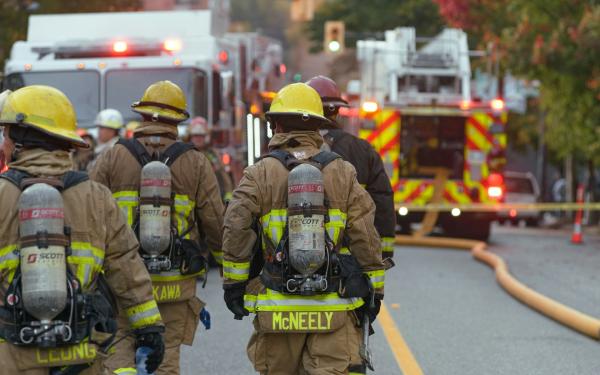
The Rock Fire, ignited on Monday afternoon alongside U.S. Highway 395 in Inyo County, has rapidly expanded to over 11,000 acres, pushing into the rugged John Muir Wilderness. Fueled by erratic winds and a monsoonal weather pattern, the fire is now threatening critical infrastructure, hiking trails, and the town of Big Pine. A fast-moving wildfire driven by 30 mph winds forced roughly 280 households in the Big Pine area to evacuate.
As of Friday morning, the Rock Fire had burned 11,974 acres and achieved 25% containment, according to incident command. An evening update on July 23 reported the fire at 11,974 acres and 20% containment, according to Inyo National Forest. By Thursday, the fire was 18% contained. Earlier reports from Cal Fire on Wednesday showed 8,000 acres and 5% containment, but aggressive aerial and ground operations have slowed the spread. The fire's western flank remains active, moving into the High Sierra, while the eastern edge is secured along Highway 395.
The terrain is described as "super hilly, super steep" by Forest Service spokesperson Ben Cossel, complicating firefighting efforts. Firefighters are using 29 helicopters, 110 engines, 4 dozers, and 2 water tenders, with night-flying helicopters continuing suppression overnight. On July 22, the fire acreage was briefly updated to 11,970 acres before being revised.
An earlier evening update on July 22 reported the fire at 11,141 acres and 15% containment, with significant progress on constructing and reinforcing containment lines. Fire activity along the southeast flank was successfully secured, allowing personnel to transition into perimeter reinforcement and initiate suppression repair in areas where the fire’s edge abuts Highway 395. The western flank remains active as the fire has transitioned onto U.S. Forest Service and Bureau of Land Management jurisdictions. CAL FIRE remains fully committed to supporting federal partners on these lands, maintaining an aggressive suppression strategy while prioritizing unified operations and addressing the needs of local communities. The primary operational focus remains on the northwest sector of the fire, where ground crews and heavy equipment are working aggressively to fortify control lines to eliminate the threat and prevent further impacts to northern communities. Firefighters will continue working through the night to strengthen containment lines and protect nearby communities. Ground crews, supported by night flying helicopters, will continue suppression efforts as conditions allow. CAL FIRE Damage Inspection Teams are also in the area as part of standard wildfire response protocols, assessing affected areas and determining whether any structures have been impacted by the fire.
Weather conditions overnight are expected to remain warm with generally light winds, allowing firefighters to continue suppression efforts through the night. Looking ahead, temperatures are expected to climb into the upper 90s with the potential for afternoon winds and isolated thunderstorms, which could increase fire activity and present additional challenges.
On July 23, the fire was very active in the northwest portion (Division Mike) but stayed within control objectives. A Thursday morning update from Inyo National Forest reported the fire at 11,645 acres. Afternoon wind shifts aligned with terrain and caused isolated runs. The fire continues to threaten Shingle Mill Bench and still has potential to threaten northern containment lines. Firefighters made progress building containment line from Highway 395 up Division Creek Road. Crews continue to mop up and patrol in the community of Aberdeen. Suppression repair has begun, with fire repair specialists inspecting the area to evaluate damage caused by fire suppression. In the coming days, additional personnel and specialized equipment will be ordered to complete these repairs. This area has a rich fire history, complicated by challenging terrain, unique weather patterns, and culturally sensitive areas. Winds will be light overnight with a chance for gusty outflow winds on Friday with highs in the mid-80s across the fire area. Active fire behavior is expected in the afternoon and evening due to hot and dry conditions.
Earlier on July 23, firefighters continued making progress building and reinforcing containment lines in steep and challenging terrain. Crews focused efforts on the northwest flank, mopping up up to 200 feet inside the perimeter. Night flying helicopters continued working across the fire, and air tankers made retardant drops where necessary. That day's weather presented challenging conditions with temperatures exceeding 100°F, low afternoon relative humidity, and mostly sunny skies. While widespread strong winds were not anticipated, terrain-driven upslope and downslope winds, along with localized gusts from any nearby thunderstorm development, could produce sudden changes in fire behavior.
On July 24, overnight fire activity moderated due to stagnant winds, allowing ground crews to make good progress constructing and strengthening containment lines. Along Highway 395, firefighters continued mop-up operations and identified hot-spots. Most of the fire behavior remained isolated to Armstrong Canyon in the northern portion of the fire, where localized torching was observed, alongside a few lingering hot spots just to the north. Incident command will focus on inserting Hotshot and Type 1 hand crews into the steep, inaccessible terrain across the northern and northwestern flanks of the fire. Air assets will provide direct support as flight conditions allow to maximize both firefighter safety and operational efficiency. The weather will again present challenging conditions with hot temperatures exceeding 100°F, low afternoon relative humidity, and mostly sunny skies. While widespread strong winds are not anticipated, terrain-driven upslope and downslope winds, along with localized gusts from any nearby thunderstorm development, could produce sudden changes in fire behavior.
A CAL FIRE afternoon update on July 22 reported the fire at 11,479 acres and 5% containment, with the cause under investigation by CAL FIRE Law Enforcement. Due to steep, rugged terrain and limited vehicle access, additional operational resources were being committed. Interagency Hotshot Crews were inserted into remote sections of the fireline, “spiking out”—establishing primitive camps directly on the line for multiple days—to construct critical handline in hard-to-reach areas. During afternoon operations, aviation assets continued active aerial support in Divisions Mike and Whiskey on the fire’s northern flank. A warming and drying trend brought triple-digit temperatures over the next several days, with dropping relative humidity and rising temperatures continuing to dry out surrounding vegetation, increasing fuel receptivity. Despite these challenging conditions, fire behavior remained moderate with improved visibility as smoke cleared, allowing ground crews to make steady progress.
On July 25, fire activity moderated overnight into Friday as winds stagnated, allowing crews to make good progress. Mop up operations continued along US395. Fire crews say Friday’s weather will provide challenging conditions as temperatures are expected to exceed 100 degrees. A Type 3 strike team from San Bernardino County Fire returned from its Rock Fire assignment, having completed its mission.
The fire has entered the John Muir Wilderness, a 650,000-acre designated wilderness area. Federal fire policy allows suppression inside wilderness with careful assessment, so helicopters and retardant are being used. The fire is about 3 miles from the Pacific Crest Trail, and officials are working to warn thru-hikers. The U.S. Forest Service closure order covers part of Inyo National Forest east of the Sierra crest, between the Birch Lake and Sawmill Pass trails. Four trailheads—Sawmill Pass, Red Lake, Taboose Pass, and Birch Lake—are closed, and hikers are advised that the Sawmill Pass and Taboose Pass trails cannot be used to descend into the Owens Valley.
The Rock Fire is burning in Inyo County, between the communities of Big Pine and Independence, along the Eastern Sierra escarpment. The area is known for its sagebrush, volcanic rock, and steep drainages. Evacuation orders remain in place for rural communities and campgrounds near the fire, and residents are urged to keep roads clear for emergency vehicles. A fast-moving wildfire driven by 30 mph winds forced roughly 280 households in the Big Pine area to evacuate.
The evacuation order covers about 200 square miles between the Sierra Nevada crest and Highway 395 near Big Pine. A map from the National Interagency Fire Center indicated that firefighters had managed to protect the one community in the burn zone — Aberdeen, a mobile home park and camping resort. Southbound Highway 395 was down to one lane in the fire area, according to the state’s Department of Transportation.
Rock is one of three big wildfires along Highway 395, which runs through the high desert at California’s eastern edge. The Biscar Fire has burned 69,344 acres northeast of Susanville; the Elephant Fire, in southern Lassen County, is 92% contained after burning 13,926 acres. Biscar, Elephant and Rock are three of the state’s four biggest wildfires of the year, said the California Department of Forestry and Fire Protection. In the No. 2 spot is May’s Santa Rosa Island Fire, at 18,379 acres. In addition to Biscar and Rock, an evacuation order was in effect Thursday for the Chute Fire, along the Yuba River near Nevada City.
Wildfires are not uncommon in this region, but the combination of monsoonal thunderstorms, erratic winds, and extreme terrain has made the Rock Fire particularly challenging. The John Muir Wilderness, established in 1964, typically prohibits mechanized equipment, but federal policy allows for wildfire suppression when values at risk are high.
The Rock Fire continues to pose a significant threat to the Eastern Sierra region, with containment efforts focused on the northwest flank near Big Pine. Residents and hikers should monitor official channels and avoid the affected areas. Firefighters remain committed to full suppression, using all available resources to protect communities and natural landmarks. For updates and details of the Rock Fire evacuation, including warning areas, see the Genasys Protect map or the Inyo County emergency website.