Tuesday, 27 October 2026, 8:44
A strong cold front is moving through Southern California this weekend, triggering significant wind and fire concerns. Meteorologists warn that dry conditions combined with gusty breezes will create hazardous outdoor environments. Residents are urged to monitor local alerts and prepare for rapidly shifting weather patterns.
Peak wind gusts will reach between 15 and 40 miles per hour depending on the specific microclimate. Forecasts indicate that these gusts will coincide with dangerously dry vegetation levels. Emergency officials cannot rule out patchy blowing dust or the rapid development of new brush fires. The combination of strong winds and arid fuel loads demands immediate caution for anyone working outdoors.
The ridge scenario will drive temperatures back up into the 90s by the week end. It is a bit of a roller coaster ride we are on in early fall.
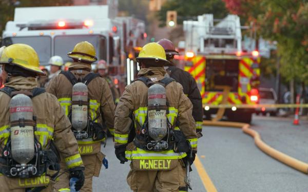
Southern California neighborhoods are already navigating heightened fire threats. In the San Gabriel Valley, the Peak Fire erupted earlier this week and quickly expanded to 22 acres. Authorities issued evacuation orders for several residential zones in Azusa and established a temporary shelter at 340 North Orange Avenue. Similar dry wind advisories have been issued for the North Bay region, where inland temperatures are projected to climb near 90 degrees alongside northerly gusts.
Afternoon highs will remain in the 70s through Saturday before the cold front pushes temperatures down into the 60s for Sunday and beyond. This shift aligns with typical mid October conditions. Overnight lows will generally settle in the 30s over the next seven nights for most microclimates. Valleys and basins will trend closer to frost and freeze territory starting Saturday night. Agricultural operators and homeowners should take steps to protect sensitive outdoor plants and crops from potential damage.
Apple Valley residents face the brunt of these atmospheric changes this weekend. The local forecast emphasizes sustained dry weather as high pressure continues to dominate the regional pattern. Active wet weather remains unlikely to break through the current setup. If these conditions persist, meteorologists suggest the area could experience an historically dry October. Local authorities recommend reducing outdoor burning and securing loose debris to prevent wind driven incidents.
Seasonal wind patterns frequently impact Southern California during the transition from summer to winter. Dry vegetation accumulates throughout the warmer months and becomes highly susceptible to ignition when exposed to sudden temperature drops and gusty fronts. Historical climate data shows that late autumn often brings volatile weather swings that challenge emergency response teams.
Communities across the region must stay vigilant as the weekend approaches. Residents should download official weather applications to track hourly wind gusts and receive immediate safety updates. Preparing homes and vehicles for dusty conditions and potential power disruptions will help ensure a safer weekend. Monitor local government channels for any evolving evacuation notices or fire restrictions.