Friday, 17 July 2026, 6:03
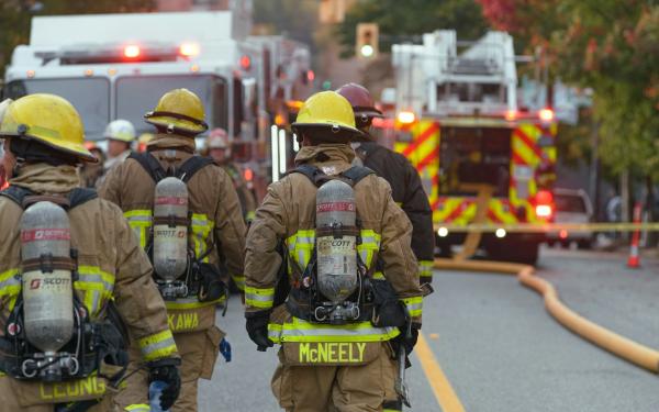
The Lower Dry Creek Fire ignited on the afternoon of July 15 near Steen Road, southwest of Milton-Freewater, and exploded in size due to hot, dry weather and gusty winds from thunderstorms. By nightfall, it had consumed more than 5,000 acres, prompting urgent evacuation orders. The Umatilla County Sheriff's Office issued Level 3 (Go Now!) evacuations for the entire community of Weston and large areas between Athena and Milton-Freewater, affecting about 1,700 residents. Level 2 evacuation notices are in place for surrounding zones. Specific Level 3 areas include: City of Weston from Schrimpf Rd to Kirk Rd and Kee's Cemetery Rd to Highway 204; Highway 204 to Basket Mountain Rd and Highway 11 to Kirk Rd; north of Wildhorse Rd, south of Highway 204, east of Wildhorse Rd and west of Lupine Lane; north of Couse Creek Rd, south of Walla Walla River, east of Highway 11 and west of Foster Rd area; Walla Walla River Rd and Couse Creek to Harris Park and Walla Walla River Rd along Lincton Mountain Rd till about 5 miles north of Highway 204, including Harris Park. Level 2 (BE SET) is in effect for NE of Highway 204 to Basket Mountain Rd between Kirk Rd and Hodgens Rd.
Oregon Governor Tina Kotek invoked the Emergency Conflagration Act on the night of July 15, allowing the Oregon State Fire Marshal (OSFM) to deploy additional resources. OSFM mobilized two structural task forces and aerial firefighting assets immediately, with more task forces en route. State Fire Marshal Mariana Ruiz-Temple urged Oregonians to remain vigilant, noting that thunderstorms and temperatures in the mid-90s are forecast for the coming week, elevating wildfire risk. This marks the third invocation of the act in 2026, following the East Evans Creek Fire in Jackson County and the Olive Butte Fire in Grant County.
The fire has destroyed at least two structures, including a residence, according to witnesses at the scene. The Red Cross has set up a temporary shelter at Sunridge Middle School in Pendleton for displaced residents. The previous shelter at Athena High School was closed due to a power outage. Firefighters are working to establish containment lines, but the blaze remains only 5% contained as of July 16. The OSFM has also deployed an Incident Management Team to coordinate efforts. Additionally, a speech camp at Meadow Wood Lane was evacuated as a precaution, with children taken to Elgin High School; parents are advised not to travel on Highway 204 due to the fire closure.
While the Lower Dry Creek Fire is in Oregon, California's history with massive wildfires—such as the 2020 August Complex Fire (over 1 million acres) and the 2018 Camp Fire (destroying 18,000 structures)—highlights the importance of rapid state mobilization and evacuation protocols. California's own Emergency Conflagration Act-like mechanisms, such as the California Governor's Office of Emergency Services (Cal OES) mutual aid system, are critical in responding to fast-moving fires that overwhelm local resources. The current Oregon fire serves as a reminder for Californians to prepare for wildfire season, especially in rural areas where response times may be slower.
The Lower Dry Creek Fire is part of a broader outbreak of wildfires across northeastern Oregon, fueled by red flag conditions including thunderstorms, high winds, and dry fuels. Other significant fires include the East Evans Creek Fire near Medford (11,551 acres, 5% contained), the Crosswhite Fire in Wheeler County (1,500 acres), and multiple fires in Gilliam and Baker counties. The 2026 wildfire season in the Pacific Northwest has been active, with above-average temperatures and drought conditions increasing fire risk.
In Wheeler County, the Crosswhite Fire by Rowe Creek Reservoir started on the evening of July 15 and is now at 1,500 acres, according to the Central Oregon Fire Information. The 250-acre Redrock and 400-acre Twickenham Fire also started about a mile northwest of Twickenham. The 200-acre Carmel Hump fire started northwest of Richmond. On the morning of July 16, the Cove Creek Fire started a mile east of the John Day Fossil Beds and is expected to be between 1,000 and 2,000 acres. Areas near Rowe Creek Reservoir were under a Level 3 evacuation order on July 16. Some surrounding areas are under Level 1 and 2 evacuation orders. Interagency hand crews and dozers are working to establish containment lines for the fires, burning in grass, brush, and timber.
In Gilliam County, the 1,000-acre Porcupine Ridge Fire and the 2,500-acre Hopskins Fire were reported on July 15, according to the Gilliam County Sheriff's Office. Firefighters and landowners are actively working to create a containment line for the two fires.
The 2,500-acre Olive Butte Fire and the 1,500-acre Salmon Fire were both at 10% containment on July 16. The 1,900-acre Anthony Fire was at 6% containment. Crews continued mop-up operations around the heel of the Salmon and Olive Butte fires, and used hand crews and dozers to establish deeper containment lines. Favorable weather allowed crews to make noticeable progress. Level 3 evacuation notices remained in place for the towns of Granite and Greenhorn, with level 1 and 2 notices in place for parts of Grant and Baker counties. Crews on the Anthony Fire worked to establish containment lines to prevent its spread north. Dozers and hand crews continued mop-up operations around the fire's southern edge and tackled hot spots. Level 3 evacuation notices were still in place for areas between Bear and Gorham Butte.
Parts of the Klamath Basin, from Klamath Falls to Lakeview, remained under a fire weather watch on July 16. The National Weather Service expected 17 mph southwest winds with gusts up to 30 mph starting on July 17.
The Lower Dry Creek Fire continues to threaten lives and property in Umatilla County, with evacuation orders in place and containment efforts ongoing. Residents are urged to follow official updates from the Umatilla County Sheriff's Office and avoid areas under evacuation. As hot, dry weather persists, the risk of new fires remains high across the region.